The Rio Grande Valley's historical heritage reaches far into the past as early indigenous Indian nomadic tribes inhabited the area as much as 11,000 years ago.
Settlement and development of the RGV began in the 1700s when Spanish
explorers traveled north from Mexico in search of treasures; gold,
silver and salt.
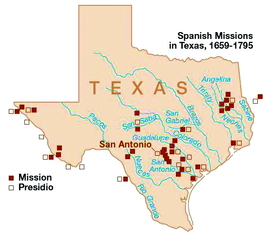
The Spanish established missions throughout Southern and Eastern Texas
but they were met with failure due to harsh conditions and unfriendly
natives.
The Valley did not see much development until the United States Civil
War during which time the Port of Matamoros became an important supply
depot for the Confederacy. At one time early on, the Anglo population of
Matamoros exceeded the Hispanic population by such a large margin that
there was an English language newspaper published there.
After the Civil War and the Mexican American War land speculators, such
as Richard King, John H. Shary and Lloyd M. Bentsen to name just a few,
brought irrigation to the Valley taking advantage of the tropical
climate and turning it into a "Magic Valley" where crops could be grown
all year 'round. In the early 1900s they promoted this concept heavily
in the Midwestern United States and even arranged for private trains to
bring prospective land buyers to the region. Once here they were given
the royal treatment, wined, dined and taken on tours of the areas citrus
groves and truck farms which had by this time become successful on a
large scale.
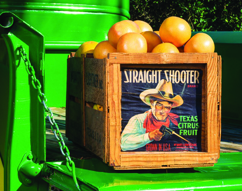
Texas has become the third largest citrus producer in the US with the
majority being grown here in the Rio Grande Valley. In addition to
citrus fruits, the Valley produces a wide variety of vegetables as well
as cotton and sugarcane.
In the 1960s the Valley saw the introduction of
maquiladoras.
A maquiladora (makilaˈdoɾa) is a manufacturing operation in a free
trade zone (FTZ), where factories import material and equipment on a
duty-free and tariff-free basis for assembly, processing, or
manufacturing and then export the assembled, processed and/or
manufactured products, sometimes back to the raw materials' country of
origin. The maquiladoras became attractive to the US firms due to
availability of cheap labor, devaluations of peso and favorable changes
in the US customs laws. In 1985, maquiladoras overtook tourism in Mexico
as the largest source of foreign exchange, and since 1996 they have
been the second largest industry in Mexico behind the petroleum
industry.
The 1960s also brought another "cash crop" to the Rio Grande Valley.
Because of the migration of Midwestern farmers in previous decades, the
tropical climate of the Valley became widely known amongst their
families and friends. Wanting to escape the frigid Northern Winters
these friends and relatives came to visit once the weather started
turning cold in their northern homelands. Commonly referred to as
"snowbirds" they came in increasing numbers year after year. Hotels and
motels sprung up across the Valley to accommodate these winter
visitors. With the rise in popularity of traveling in recreational
vehicles came the development of campgrounds, RV parks and mobile home
resorts. Somewhere along the line, the term "snowbirds" was replaced by
the more affectionate term
"Winter Texans"
as they are known today. It is estimated that between 100,000 and
150,000 Winter Texans call the Valley their home for the winter every
year.
June 2014 ...
A Rich and Diverse Cultural History
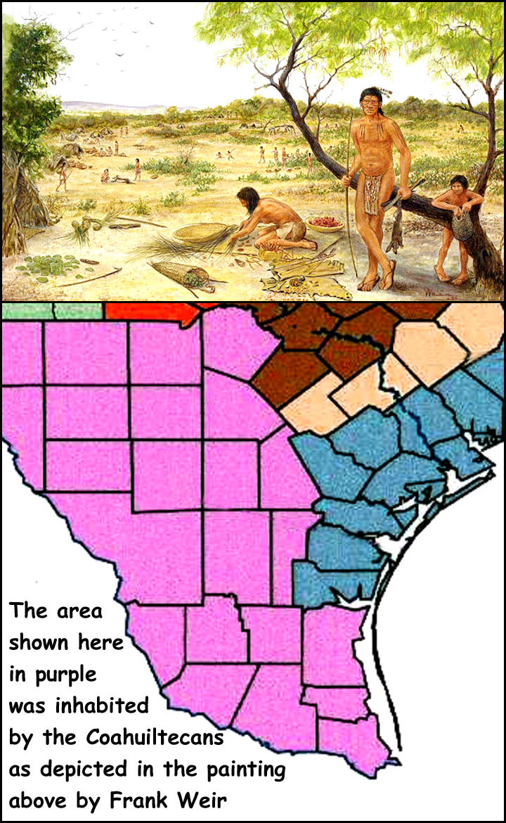
It is widely believed that Native Americans
have resided in South Texas for at
least 11,000 years.
These early inhabitants were hunters and
gatherers as evidenced by artifacts found
dating to the Archaic Period. Eventually,
some forms of agriculture, such as raising
maize, was introduced and thus began
the agricultural growth of the area.
In the 16th century, as Spanish explorers
began venturing into the area,the history
of the South Texas Plains began to
be recorded in written form.
At this time hundreds of small, mobile
groups of hunter / gatherers spread
across southern Texas and northeastern
Mexico. These groups have collectively
become known as Coahuiltecans, however
individual tribes went by the names
of Payaya, Pacuache, Mariames and
dozens of others whose names have been
lost to history. These tribes spoke in a
vairety of dialects somewhat related to
each other such as Comecrudo, Cotoname,
Aranama, Solano, Sanan, as well
as Coahuilteco. Sharing overlapping territories,
particularly in the prickly pear
season, many of these tribes co-existed
peacefully.
Others were sworn enemies
of one another or simply had such widely
separated territories that they rarely
came in contact with each other.
The Coahuiltecans hunted a wide variety
of animals, fished, gathered berries,
fruits, and roots. During the Summer a
major food source for them were "tunas",
the tasty and nutritious fruit of
prickly pear cactus found in abundance
in this region.
La Sal del Rey, located in north-central
Hidalgo County, is one of several natural
salt lakes on the coastal plain north
of the Rio Grande.
Throughout historic
times and likely throughout prehistory
as well, the crystal-covered shores of
La Sal del Rey attracted both people
and animals.
An important mineral for
human nutrition, salt was also a critical
ingredient for preserving meat and
animal hides. Early inhabitants of South
Texas obtained salt for their own uses,
and possibly for trade as well.
Prehistoric trade in the lower Rio Grande
region is evidenced by pottery shards found at occupation sites near
Brownsville, which originated in the Huastec culture area on Mexico's
Gulf Coast
near Vera Cruz.
Shell ornaments characteristic
of the peoples near the Gulf coast
(the "Brownsville Complex") occur
at sites well inland, including Hidalgo
County. Salt may well have been a factor
in these trading activities. In addition,
local lore maintains that Indians from
the Mexican interior, including Aztecs,
obtained salt from La Sal del Rey.
Accounts of Aztec trade with northern
regions, as told in Spanish writings, may
lend credence to this tradition. More tangible
are obsidian artifacts found in the
Valley, their origins have been traced as
far away as central Mexico, indicating
definite links with that region.
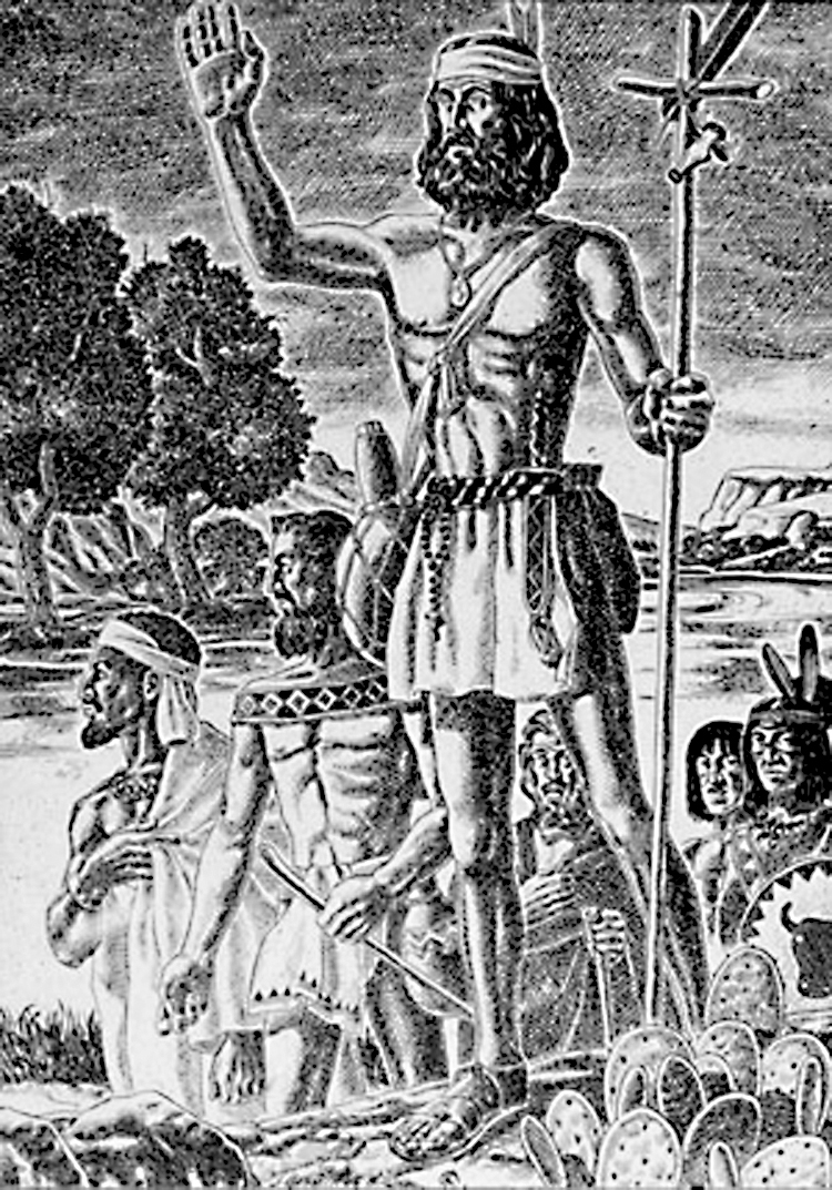
Beginning in the 16th century Spanish
explorers traveled north from Mexico.
Searching for gold, these Spaniards traveled
first into what is now New Mexico
and then made their way along the Rio
Grande River into South Texas.
Watch for next month's issue
to read about the influence of
Spanish exploration on the
early history of the Rio Grande Valley.
July 2014 ...
Early Exploration of South Texas
"Difficult and Dangerous"
Francisco de Garay, a fellow spaniard, traveled with Christopher Columbus
on his second voyage to the "New World" in 1493. In 1514 he was
appointed as govenor of Jamaica by Spain's King Ferdinand. In 1519
Garay outfitted four ships to explore the northern Gulf shore and placed
them under the command of Alonso Alvarez de Pineda. Pineda and his
men were the first Europeans to explore and map the Gulf of Mexico
shorline from Florida to South Texas.
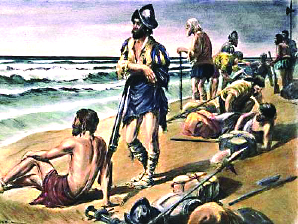
In 1527 Spain sent an expedition led by Panfilo de Narvaez in an attempt
to colonize "Spanish Florida". The expedition failed after the initial 600
men were reduced to only about 250 by hurricanes, attacks by indians,
poor food and disease. In September of 1528 these 250 "survivors"
sailed westward on crude rafts along the gulf coast. Storms and strong
currents swept several of the rafts out to sea, including Narvaez's, where
they were permanently lost. Cabeza de Vaca, the remaining captain, and
about 90 others continued along the coastline until they were eventually
shipwrecked on what is today Galveston Island.
Here they established a temporary encampment but soon found themselves
decimated by sickness and attacks from local indians. By the spring of
1529 there numbers had dwindled to about fifteen. A dozen of these
explorers left Cabeza de Vaca and headed south toward Mexico.
Nine of them died from mishaps and indian attacks leaving only
Alonso del Castillo, Andres Dorantes de Carranza, and his slave, the
African Estevanico who survived by becoming slaves of Coahuiltecan
Indians, the Mariames and Yguaces.
Meanwhile, Cabeza de Vaca and his two remaining countrymen explored
inland from Galveston Island. Passing from tribe to tribe for up to
3 years, Cabeza de Vaca developed sympathies for the indigenous
population.
He became a trader, which allowed him freedom to travel
among the tribes. Cabeza de Vaca claimed that he was guided by God
to learn to heal the sick and gained such notoriety as a faith healer
that
he and his companions gathered a
large following of natives who regarded
them as "children of the sun", endowed with the power to both heal
and destroy. Many natives accompanied
the men across what is now the
American Southwest and Northern
Mexico. An astonishing turn of fate
re-united Vaca with
the three survivors who had been enslaved by the local indian tribes
when he met a tribe known as the Quevenes at Matagorda Bay in 1532.
Unfortunatley for Cabeza de Vaca, he
now also was enslaved by the Mariames
indians.
When an opportunity for escape presented itself in late summer 1534
they headed south toward the Rio Grande River. It was their good luck
to be accepted by friendly Avavares Indians who ranged southwest of
Corpus Christi Bay. They remained with these natives for eight months
before leaving them in late spring 1535 and crossing the Rio Grande
into Mexico near the present-day International Falcon Reservoir.
These "ragged castaways" as they were later called, made their way along the
Rio Grande River to what is now El Paso where they tuned southward
and eventually arrived in Mexico City in July 1536.
In all they had walked on bare feet an estimated 2,400 miles from where
they had fled the Mariames and Yguaces in Texas.
August 2014 ...
Spain Ignores Texas Until Threatened by French Colonization in the Territory
As a result of the fact that no vast riches were
discovered in the area of New Spain which is
modern day Texas, the spanish royalty ignored
texas until 1685 when the French explorer
Robert Cavelier de La Salle established Ft. St.
Louis in what is now Victoria County, Texas.
Spain's King Carlos II, perceived the French
colony as a threat to Spain's claims in the territory
and launched 10 expeditions trying to locate
Ft. St. Louis.
In 1689 the Spanish explorer
Alonso de Leon finally discovered the remains
of the French colony which had lasted only
3 years due to epidemics, indian attacks and
harsh conditions. Years later, Spanish authorities
built a presidio at the same location. When
the Spanish presidio was abandoned, the site of
the French settlement was forgotten to history.
The importance of these spanish expeditions
lies in the fact that De Leon sent a report of his
findings to Mexico City, where it created instant
optimism and quickened religious fervor.
The Spanish government was convinced that
the destruction of the French fort was "proof
of God's 'divine aid and favor'". In his report
de Leon recommended that presidios be established
along the Rio Grande, the Frio River,
and the Guadalupe River and that missions be
established among the Hasinai Indians, whom
the Spanish called the Tejas.
Viceroy Antonio de Mendoza approved the
establishment of a mission but rejected the idea
of presidios (fortified bases).
On March 26, 1690, Alonso de Leon set out
with 110 soldiers and several missionaries and
established Mission San Francisco de los Tejas
near the eastern Texas Hasinai village of
Nabedaches in late May.
Smallpox epidemics, drought and hostilities with the local indians
caused this mission to be abandoned in 1693.
After several failed attempts to re-establish
the mission it was relocated to the area which is
now San Antonio and was renamed San Francisco
de la Espada. Many Spanish missions were established in
what is presently Central and East Texas during
the late 1600s and early 1700s.
Mission San Antonio de Valero was established
on May 1, 1718 as the first Spanish mission
along the San Antonio River. It was named
for San Antonio de Padua, the patron saint of
the mission's founder, Father Antonio de Olivares
as well as the viceroy of New Spain, the
Marquis de Valero. This is the mission that later
became known as the Alamo.
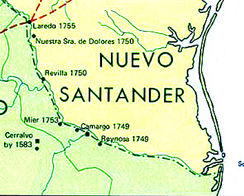
In 1749, in a major colonizing effort along
the Rio Grande, four towns were founded on
the south bank of the river in Mexico: Reynosa,
Camargo, Mier and Revilla (now Guerrero).
Some time later, the missions in these settlements
all established outposts on the Texas side
when some of the settlers began to move across
the river. These outposts were visitas and took
their names from those missions.
A visita was
a kind of country chapel that was visited by the
priests for Mass or to administer sacraments.
One of these visitas was in Zapata County. It was an outpost of the Mission San Francisco
Solano de Ampuero that was in the Mexican
town of Revilla. Called Mission Revilla a Visita,
it is commemorated with a state historical
marker in the present-day city of Zapata at the
courthouse plaza.
Also in Zapata County was the ranch settlement
of Nuestra Senora de los Dolores, established
in 1750, about 11 miles north of San Ygnacio.
Today, the site is referred to as Dolores
Hacienda. Although a state historical marker
put up by the Texas Centennial Commission in
1936 says there was a mission there, later research
indicates there was only a small chapel
for religious services provided by priests from
Revilla.
In 1755, another ranch settlement was founded
on the east bank of the river at Laredo. Until
1760, when it received its first resident secular
priest, Franciscan friars from the Revilla mission
visited Laredo on occasion to minister to
the settlers.
The Mexican city of Mier was the site of the
mission La Purisima Concepcion, and across
the river in present-day Starr County was Mission
Mier a Visita, begun sometime in the mid-
1750s. There is a state historical marker on US
83, 3.5 miles west of Roma.
At the same time,
another visita was established from San Agustin
de Laredo mission in Camargo, Mexico.
There is a state historical marker 2.5 miles west
of Rio Grande City on US 83.
Farther south in Hidalgo County a visita was
established in the mid-1750s from the mission
San Joaquin del Monte in Reynosa. A marker
in McAllen Park in Hidalgo commemorates the
visita.
September 2014 ...
Early Colonization of Spanish Texas
By the end of the 18th century there were
about 3,500 spanish colonists in the area
known as Spanish Texas. Many of the settlers
were former soldiers who had been
stationed at the various presidios during
the time that missions were being established.
Others were immigrants brought by
the Spanish government from the Canary
Islands and there were the missionaries
who had come in the early 1700s to spread
Christianity among the native Indians.
Life was particularly difficult and dangerous
during this period of Texas history.
While some native tribes of Indians accepted
the Spanish and co-existed peacefully,
there were others who did not take kindly
to the Spaniards efforts to force their way of
life upon them.
To make matters worse, the westward
expansion of American pioneers forced
Indian tribes such as the Apaches and the
Comanches to migrate into Spanish Texas.
Because these two tribes were constantly
warring with each other, their presence in
Texas caused hardships for the Spanish settlers
as well as the native tribes of the area.
It was during this tumultuous time that the
Spanish government awarded land grants in
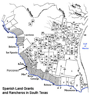
the area known then as Nuevo Santander.
The land was divided on the basis of merit
and seniority. Due to the shortage of water
sources, porciones were long narrow strips
of land bordering the river.
These porciones were a little over a half mile wide and about
12 miles deep.
Families were also given a
small plot in town to build a house, if they
wished. Many of the buildings on each porcion
were placed near the Rio Grande, just
far enough away to avoid flooding, and the
rest of the land was used for sheep, goats,
and cattle.
Larger grants were made at the back of
the porciones or along the Gulf of Mexico
which went to influential citizens of Camargo
and Reynosa. These land grants were
several hundred thousand acres in size. At
this time the landscape consisted of grassy
plains with brushy areas concentrated near
waterways. These large land grants were
used mainly for cattle ranching.
No fences were used, and the animals
could roam as they pleased across boundaries.
Mesquite trees became more abundant
in the region as a result of these free roaming
cattle. Cattle belonging to different owners
would often merge together into large
herds, and would only be separated during
a rodeo, or roundup. Over time, these wild
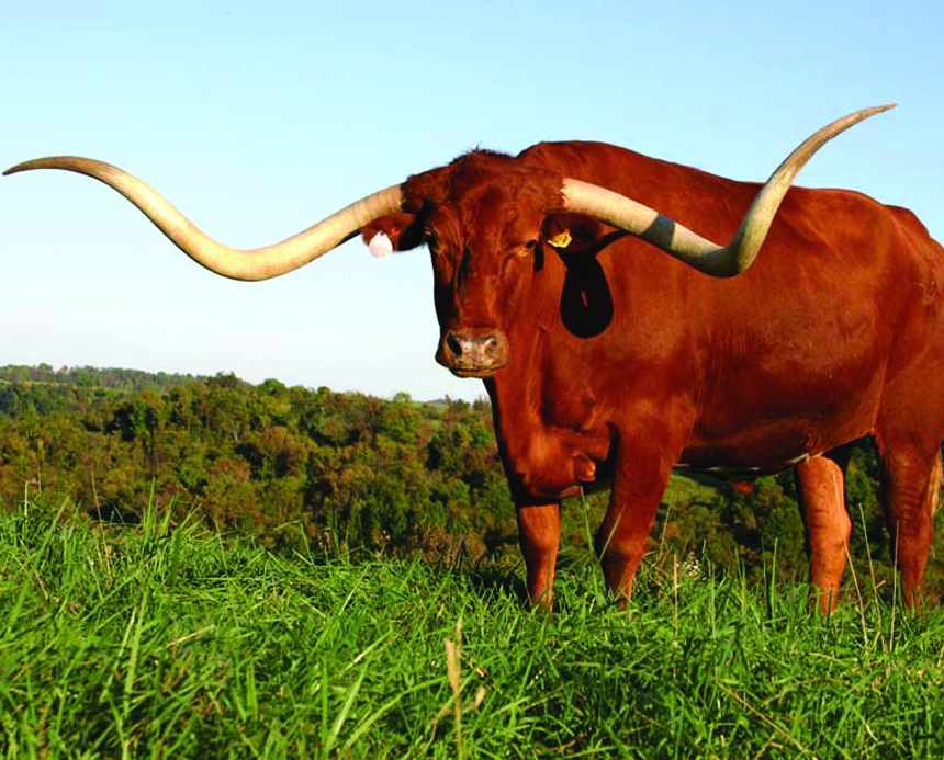
herds of cattle would evolve into the Texas Longhorn so familiar today.
Protection from Indian and Bandit raids
against these ranchos was provided by the
Spanish military based in the villas along
the Rio Grande River.
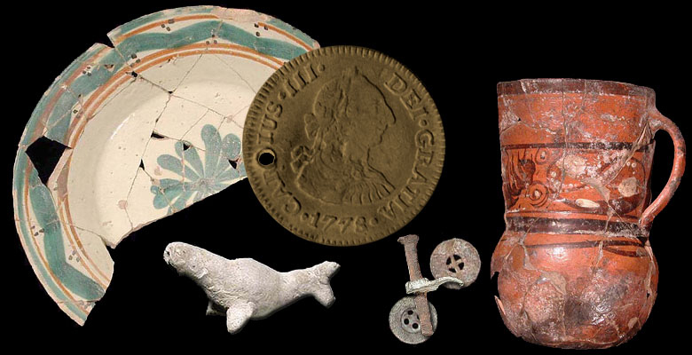
In 1951, archeologists from the University
of Texas excavated several sites along the
Rio Grande River in advance of construction
crews who were to build Falcon Dam
near present day Zapata. Below are some
artifacts that were discovered during these
excavations.
A Local Resident's Connection to the Past
Gordon Jenkins, a present day
resident of the RGV, traces his
family's heritage back to the land
grants of the 1700s.
He tells the story of his ancestors,
the Cardenas family, who
acquired the land grant called San
Salvador del Tule near what is today,
Edinburg.
This land grant consisted of over
300,000 acres. Included within it's
boundaries is the salt lake known
as "Sal del Rey", a revenue source
for the Spanish Crown since it imposed
a one-fifth tax on the salt
that was sold.
Antonio Cardenas, a prominent
citizen of Reynosa, had an interest
in the land and so did Capt. Jose
Maria Balli an officer of the Spanish
military posted in Reynosa.
However, Cardenas elected not
to bid against Capt. Balli for the
land grant because he realized that
the Spanish soldiers from Reynosa
provided the only protection
against Indian and Bandit raids on
the frontier ranchos.
The Tule lands were granted to
Capt. Balli's son Juan Jose Balli
in 1798. Balli obtained a business
loan from the Cardenas family
to develop the land. Balli was
charged by Spanish officials with
smuggling salt from El Sal del Rey
and not paying the King's tax. He was also suspected of aiding the
cause of Mexican independence
from Spain.
He was imprisoned in 1804 at
Altamira prison in San Carlos,
Mexico, and died there on May 9
of that year. San Salvador del Tule
was passed to his heirs.
In 1829 members of the Cardenas
family demanded payment on
the loan that was given to the Ballis
back in 1798. In lieu of payment
the Balli family gave the San Salvador
del Tule land to the Cardenas
family who then established
La Noria Cardenena Ranch. Ranch
headquarters was on the Old Salt
Road from the historic royal salt
lake, El Sal del Rey, which was
part of the ranch, to Cerralvo.
Cardenas and Cavazos families,
who owned adjacent land, were
united by the marriage of Amado
Cavazos and Manuela Cardenas
in 1862. There followed many
other marriages between the two
families. Together they built a
strong cattle-ranching community,
which became the hub of over 40
ranches. During the Civil War, the
Cardenas family fled to Mexico.
The Confederate government of
Texas seized El Sal del Rey for its
valuable salt. After 80 years of litigation,
the Cardenas family recovered
parts of San Salvador del Tule
in a landmark decision involving
sovereign mineral rights.
The two families have held reunions
since 1913. The main
ranchhouse built in 1855-1865 still
stands.
October 2014 ...
Transition From Spanish Texas to Mexican Texas
By the late 1700s a nice little society
was growing in Nuevo Santander (present
day Texas). But the people were
beginning to feel far removed from the
King in Spain.
Without offering much support, Spain
taxed the colonies, cut off funding to
the missions and strictly enforced laws
which the colonists believed to be unfair.
Further south in New Spain, tensions
were developing between Spaniards
born in Spain, known as peninsulares
and Criollos, locally born citizens of
pure Spanish descent.
Spurred by the defeat of Spain by Napoleon
in 1808 the peninsulares took
control of the local government of New
Spain. Criollos supported by the Indians
and mestizos (people of Indian and
Spanish blood), conspired against this
new ruling class and began the fight for
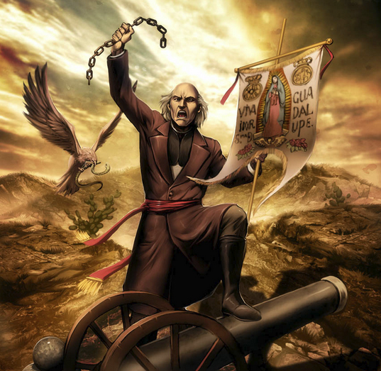
Mexican Independence.
After more than a decade of bloody
war, independence was won in 1821
and the territory was given the name of
Mexico after its capitol, Mexico City.
Having been illegal under Spanish rule
until 1820, Anglo-American immigration
into Nuevo Santander was expanded
by Mexico's National Colonization
Law of August 18, 1824. However, this
law favored Mexican immigrants from
the south, soldiers and nomadic Texas
tribes by giving them priority in acquiring
land. Between 1821 and 1835, forty-
one land contracts permitted 13,500
families, mostly Anglo-Americans, to
settle in Texas.
Anglo-Americans were attracted to
Mexican Texas because of undeveloped
land which could be purchased for $1.25
an acre for a minimum of 80 acres. Each
head of a family, male or female, could
claim a headright of 4,605 acres (one
league-4,428 acres of grazing land and
one labor-177 acres of irrigable farm
land) at a cost about four cents an acre
($184) payable in six years.
Stephen F. Austin received one of the
first grants to establish a colony in Texas
on August 1823 on land acquired by
his father, Moses Austin, from Spain in
1820. Two thousand settlers settled in
the new colony that stretched from the
east coast of Texas to La Grange.
By 1834, over 30,000 Anglos lived in
Texas, compared to 7,800 Mexicans.
Antonio Lopez de Santa Anna became
the president of Mexico in 1833. In
1835 he dissolved the Congress and his
regime became a dictatorship backed by
the military.
November 2014 ...
The Rio Grande Valley During
The Texas Revolution and The Mexican American War
Following the Mexican War of Independence
the Rio Grande Valley was part of Coahuila y
Tejas which was formed through the United
Mexican States 1824 Constitution.
Matamoros and Reynosa had been established
south of the Rio Grande River but were
little more than sleepy border towns.
The area north of the river was a sparsley
populated area inhabited by settlers of these
towns. The territory, having been divided into
porciones and land grants, was primarily used
for ranching and consisted of vast areas of
grasslands with woody areas located around
sources of water near the river.
Cattle raising was successfully established in
the area despite hardships caused by flooding
and Indian raids.
In the 1820s, early Anglo-American settlers
led by Stephen F. Austin colonized Texas in areas
north of the Colorado River between San
Antonio and the Eastern border with Louisiana.
The Mexican government tried unsuccessfully
to encourage Mexican citizens to settle in Texas
and the Anglo-American settlers soon out
numbered Mexicans nearly four to one. Fearing
annexation of Texas by the United States, the
Mexican government banned further immigration
from the US in 1830. This action is said to
be one of the main factors in causing Texas to
revolt and seek independence from Mexico.
Like other Mexican states discontented with
the central Mexican authorities, the Texas department
of the Mexican state of Coahuila y Tejas
rebelled in late 1835 and declared itself independent
on 2 March 1836. Santa Anna marched
north to bring Texas back under Mexican control
by a show of brute merciless force. Santa
Anna's force crossed the Rio Grande above Laredo
on February 16, 1836. A second Mexican
force, led by Gen. Jose de Urrea, crossed the Rio
Grande at Matamoros the next day.
Major battles in the war for Texas' independence
took place in the territory from San Antonio
to the Eastern border, however there was
some action in the Lower Rio Grande Valley.
The Matamoros Expedition
In February of 1836 Colonel James Fannin led
a force of around 200 men on an ill fated attempt
to attack Matamoros to prevent it from
being used as a staging point for the Mexican
army. Unfortunately, escaped Mexican prisoners
were able to warn Gen. Urrea of the plan.
Urrea's army marched north and defeated Fannin's
forces at Goliad, executing 342 prisoners
of war under the direct order of Santa Ana.
The Texas Navy
In November 1835 the provisional government
of Texas established an official navy. In
January 1836, agents purchased four schooners:
Invincible, Brutus, Independence, and Liberty.
According to Teddy Roosevelt, the Texas Navy succeeded
in preventing reinforcements and provisions at the Mexican
naval base at Matamoros from reaching General
Santa Anna's forces then occupying Texas.
This forced Santa Anna to disperse his large
army, to forage for food and supplies and in
turn led to his defeat at San Jacinto by General
Sam Houston in April, 1836 and the signing of
the Treaties of Velasco.
The Mexican government's refusal to acknowledge
the Treaties of Velasco eventually
led to the Mexican American War following
the annexation of Texas by the United States
in 1845.
The United States claimed Texas' southern
border to be the Rio Grande River while Mexico
saw it as ending at the Nueces River.
After a declaration of war on May 13, 1846 US
forces invaded Mexican territory on two main
fronts. The US War Department sent a US cavalry
force under Stephen W. Kearny to invade
western Mexico from Jefferson Barracks and
Fort Leavenworth, reinforced by a Pacific fleet
under John D. Sloat. This was done primarily
because of concerns that Britain might also try
to seize the area. Two more forces, one under
John E. Wool and the other under Taylor, successfully
occupied major cities in Mexico as far
south as the city of Monterrey.
Military conflicts in the Lower Rio Grande
Valley during the Mexican American War include
the Siege of Fort Brown, in Brownsville
and the battles of Palto Alto and Resaca de la
Palma.
Outnumbered militarily and with many of
its large cities occupied, Mexico could not defend
itself and signed the Treaty of Guadalupe
Hidalgo on February 2, 1848. The treaty gave
the US undisputed control of Texas firmly establishing
the US-Mexican border as the Rio
Grande River.
December 2014 ...
The Civil War Era in the RGV
After the end of the Mexican-American
War the population of Texas grew rapidly
as migrants poured into the cotton
lands of the state. In addition to Americans
moving into Texas, thousands immigrated
from Germany and Czechoslovakia.
Cotton plantations brought with them
slavery, and in 1860, 30% of the total
state's population of 604,215 were
slaves. Texas declared its secession
from the United States on February 1,
1861, and joined the Confederate States
of America on March 2, 1861.
It is estimated that in 1861 only one
third of the white population in Texas
supported the Confederacy.
Those loyal to the Union were mainly from the northern counties, the German districts and the Mexican areas. Large
scale massacres against these unionists
caused many to flee south across the Rio
Grande River into Mexico.
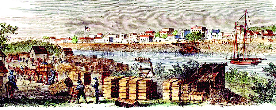
During the Civil War, the Rio Grande
River delta was a vital depot for the
Confederate cotton trade.
With Union ships blockading ports from Virginia to
Texas, Confederate leaders transported
their "white gold" across the Rio
Grande, loaded it onto Mexican flagships
in the Port of Bagdad and sailed
it safely past the blockading forces.
Fort Brown, in Brownsville, became a
strategic location for this thriving trade.
In November 1863, Union troops
invaded Texas at Brazos Island and
marched inland successfully occupying
Brownsville in an attempt to halt
the flow of cotton. They held the territory
until July 1864 when Confederate
troops recaptured the city. Union forces
were forced to withdraw to Brazos Island
where they remained stationed for
the remainder of the war.
Few battles actually took place in
Texas during the civil war. However, the
Rio Grande Valley is the site of the last
battle of the war. The Battle of Palmito
Ranch was fought in May 1865, one
month after the surrender of Confederate
Gen. Robert E. Lee in April 1865. Ironically,
the Confederate troops claimed a
victory in this the final conflict of the
Civil War.
The Lost Cities of the Rio Grande Valley
The Port of Bagdad
Bagdad, Tamaulipas, Mexico
was a town established in 1848 on
the south bank of the mouth of the
Rio Grande River inside the municipality
of Matamoros. In 1861
Matamoros had a population of
about 40,000 and the Port of Bagdad
population was nearly 12,000.
Prior to the American Civil War,
Bagdad was but a recreational
destination for the residents of
Matamoros. When the Mexican-
American War broke out, Matamoros
was split into two cities.
Those residents with loyalties to
the United States moved north of
the Rio Bravo (the Rio Grande)
and created Brownsville. However,
Bagdad continued on as a destination
for recreation for the people
of both cities.
During the American Civil War,
Union warships bottled up Southern
ports. In response, the Confederacy opened a back door on the
Rio Grande River, which by treaty
was an international waterway.
Cotton was the "white gold" that
would sustain the Confederacy
during the Civil War, and cotton
was literally "King" in south
Texas.
Richard King, owner of
the famed King Ranch, along with
several partners, was a major player
in the cotton trade during this
time period.
Cotton was hauled by wagon,
oxcart and mule cart to Matamoros
where many speculators and
agents vied for this valuable commodity
to ship to Europe. They
offered in exchange vital goods:
guns, ammunition, drugs, shoes &
cloth. At Bagdad, cotton was loaded
from small boats onto ships in
the Gulf of Mexico. Goods crossing
here played an important role
in the South's war effort.
Clarksville
Clarksville, Texas was near the
mouth of the Rio Grande, opposite
the Mexican city of Bagdad. During
the Mexican War a temporary
army camp stood there, with William
H. Clark, a civilian, in charge.
Clark set up a country store and
served as agent for the steamship
lines using the port. The town
quickly developed; houses were
built up on stilts to be above high
water. During the early part of the
Civil War Clarksville thrived on
the trade of the Confederate blockade-
runners, but in 1863 it was
captured by federals, who held it
most of the time until the end of
the war.
Brazos Santiago
The Port of Brazos Santiago was
located on Brazos Island in what is
now Cameron County, across Brazos
Santiago Pass from the south
end of Padre Island.
By 1867 the north end of Brazos
Island was a well-developed
military port with three wharves
on Brazos Santiago Pass, a railroad
south to Boca Chica and on to
Whites Ranch on the Rio Grande,
four barracks, a hospital with four
outbuildings, two gun emplacements,
numerous warehouse buildings,
and a lighthouse. After the
Civil War the troops left Brazos Island,
and the small town of Brazos
faded away.
 Natures Fury
On October 7, 1867 an intense hurricane struck the mouth of the Rio
Grande with great fury and devastated the towns of Clarksville, Texas,
Brazos Santiago, Texas and Bagdad, Tamaulipas, Mexico. In 1874, another
storm roared ashore at the mouth of the Rio Grande River. A storm
surge of over twenty feet inundated much of the shore from the mouth
of the river north. These natural disasters spelled the end of the Lost Cities
of The Rio Grande Valley and very little physical evidence remains
today to prove their existence.
January 2015 ...
Early Development of the Rio Grande Valley as an Agricultural Center
The lower Rio Grande contains
good agricultural land, the region
being a true delta and the soil varying
from sandy and silty loam
through loam to clay. The area of
about 43,000 square miles witnessed
a tremendous development
in a period of about thirty years
from the late 1800s to through the
early 1900s.
This spectacular development is
attributable to two factors: the introduction
of irrigation on a large
scale in 1898 and the building of
the railroad in 1904.
Before that time the Valley was
little more than quasi-desert rangeland.
When the Spanish first occupied
the area around 1750, they
settled on the right bank of the river
and divided the area north of the
river into great cattle-ranch grants.
The first American settlement in
the area was Brownsville, which was founded as a result of the invasion
of Zachary Taylor and the
United States Army in the Mexican
War (1846). The town, which
sprang up around Fort Brown, remained
practically the only settlement
of size or distinction in the
Valley for over half a century.
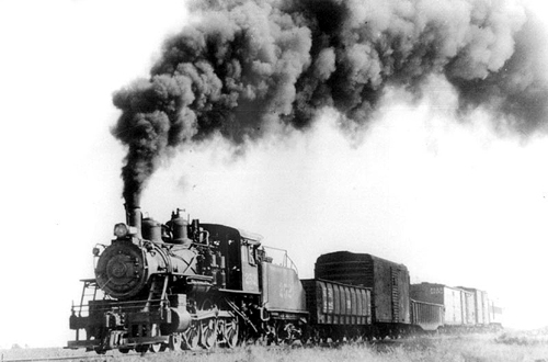
The coming of the railroad and irrigation
made the Valley into a major
agricultural center. In Hidalgo
County, land that had been selling
for 25 cents an acre in 1903, the year
before the St. Louis, Brownsville
and Mexico Railway arrived, was
selling for $50 an acre in 1906
and for as much as $300 an acre
by 1910.
A large-scale migration
of midwestern farmers in the teens
and twenties, matched by a growing
surge of Mexican immigration
during the same period, led to dramatic
population growth in Valley
counties.
The population of Cameron County
grew from just over 16,000 in
1900 to 77,540 in 1930; that of Hidalgo
County climbed from 6,534
in 1900 to 38,110 in 1920 and just
over 77,000 in 1930. By 1930 the
population of the four lower Rio
Grande valley counties exceeded
176,000.
After the arrival of the railroad in
1905 the town of McAllen began
developing. With the introduction
of an irrigation system vegetable
farming was now possible. The
Valley became a truck garden center
for tomatoes, cabbage, carrots,
potatoes, beets, corn, green beans,
and onions.
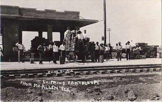
Cotton and sorghum became important
staples early on, but the
most important crop in the region
is citrus fruit.
Introduced commercially in the
region in 1904, citrus fruit culture has survived severe freezes in
1949, 1951, 1961, 1983 and 1989.
Soon McAllen had a hotel, a grocery
store, a Presbyterian church, a
bank, and a weekly newspaper. In
1916 after bandits caused border
trouble 12,000 soldiers were sent
here to restore law and order. Business
boomed with the increased
population.
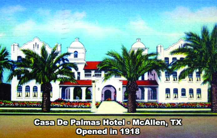
The Casa de Palmas Hotel, opened
in 1918 and served as a business,
social, and civic center for the Rio
Grande Valley.
February 2015 ...
THE "MAGIC VALLEY"
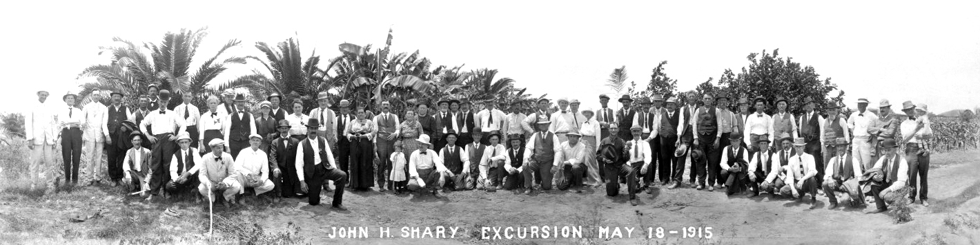
When it comes to understanding how
the Rio Grande Valley became The Magic
Valley, two pioneers stand in the forefront:
John H. Shary and Lloyd Millard
Bentsen, Sr.
John H. Shary
John Harry Shary, the son of Bohemian
immigrants was born on a Saline County,
Nebraska, farm on March 2, 1872. At
the age of 22, John joined a California
redwood lumber firm for which he traveled
throughout the United States and
in Canada.
He became
interested in
land investments
and development,
particularly in Texas.
Between 1906
and 1910 he and
George H. Paul developed
250,000
acres in the cotton producing
area around Corpus Christi,
operating from out-of-state offices with
special trains transporting prospective
buyers to South Texas on a weekly basis.
Impressed by the commercial potential
of citrus-growing experiments in the
lower Rio Grande Valley region John
Shary bought and subdivided more than
50,000 acres of land in the Valley and installed an irrigation system.
With the financial help of Jesse H.
Jones he bought most of the early experimental
citrus groves, especially grapefruit,
and from them he harvested some
of the early commercial citrus crops after
World War I.
John became very influential in the
Valley. He headed numerous commercial
firms, including banks, land companies,
and newspapers, and was a director of the
Intercoastal Canal Association and the
St. Louis, Brownsville and Mexico Railway
Company. John and his wife Mary
lived on the Shary Estate in Sharyland,
northeast of Mission. They also maintained
homes in Omaha, Nebraska, and
Branson, Missouri, thus qualifying them
as what we today call "Winter Texans".
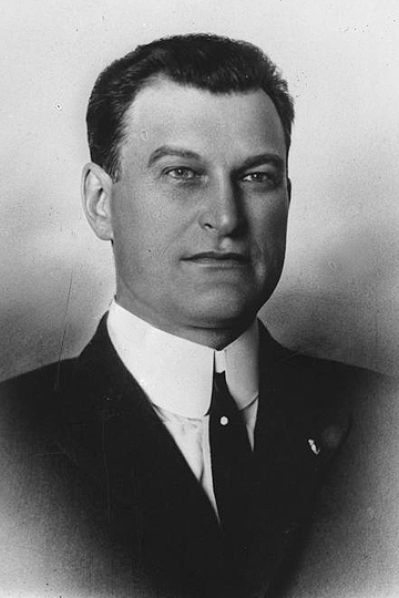
 Lloyd M. Bentsen Sr.
In 1918, heeding medical advice, Peter
and Tena Bentsen left their homestead
in Argo Township, South Dakota and
drove by car for 17 days and 1,675 miles
to Sharyland, Texas. They were accompanied
by their son Lloyd and his wife,
Dolly. Arriving penniless, Peter Bentsen
rented a place in Mission and began
working as a land agent for John Shary.
Lloyd and his brother Elmer Bentsen
became the premier colonizers and developers of Hidalgo County, which
led all counties of the United States in
cotton production and raised a good part
of the Valley's 1948 $100 million citrus
and vegetable crop. In 1952 the county
centennial program described the contribution
of Lloyd and Elmer's stake in the
county's economic development. The
Pride O Texas citrus trademark contributed
substantially to the fortune that the
Bentsen family began amassing.
Elmer and Lloyd were principals in the Elsa
State Bank, Elmer a president and director
and Lloyd on the board of directors.
Lloyd was also a principal in the First
National banks of McAllen, Mission,
Edinburg, Raymondville, and Brownsville.
He served as president of the Rio
Grande Valley Chamber of Commerce
from 1944 to 1946
and was instrumental
in uniting and
developing Cameron,
Hidalgo, Starr,
and Willacy counties.
Later in life he
became sensitive to
preserving the natural
environment of the Valley and donated
land that became the
Bentsen-Rio
Grande Valley State Scenic Park.
May 2015 ...
The Forgotten Americans ...
The Story of Rio Rico
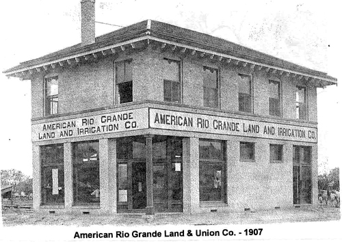
In 1906 the Rio Grande Land and Irrigation
Company owned the tract of land south
of Mercedes, TX which is now known as
the Horcon Tract. Located on this tract of
land was a small Texas town called Rio
Rico. Owners of the company were concerned
that the Rio Grande River, the official
boundary between Texas and Mexico,
would shift its course leaving their new irrigation
pumping station high and dry.
Without legal authorization, they diverted
the river's course manually by blasting and
digging a new channel north of the town of
Rio Rico. When all was said and done, Rio
Rico, TX was left south of the river.
American authorities charged the company
with violating treaties with Mexico that
forbade artificial water diversions. Those
treaties also stipulated that while such diversions
might change the course of the
river, they did not change the international
boundary. The company paid a $10,000 fine
in 1911, and also paid $2,000 to survey and
mark the international boundary in the nowdry
riverbed.
Even though the tract of land was legally
still a part of the United States, its location,
now south of the river, caused it to come
under the jurisdiction of Mexican authorities
in the area.
Local Texans paid little attention to this
situation. In fact the town of Rio Rico prospered
as a gambling community during the
prohibition years. A Chicago syndicate, rumored
to have ties to Al Capone himself,
developed Rio Rico in 1928. They built a
greyhound race track and saloons and welcomed
Texans to come and enjoy themselves.
Some say that they may have smuggled
narcotics out of Mexico by hiding the
drugs under the blankets placed over the
dogs after a race.
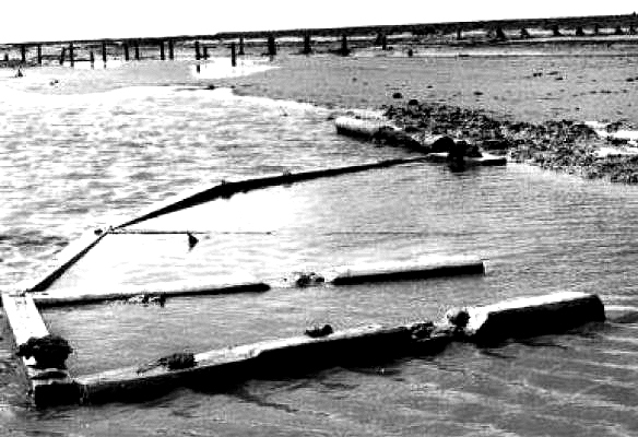
For 10 cents, anyone could cross a two
lane, 260-foot suspension bridge built in
1928 linking Rio Rico, on the south end of
the bridge, and Thayer, Texas.
"The story goes, in one year they paid back
the bridge completely on that 10-cent fee.
That's how many people went over there,"
said Laurier McDonald, retired Edinburg attorney and local historian.
The town's resort status plummeted at the
end of prohibition in the mid-1930s. When
a storm washed away the bridge in 1941,
the town became just another small border
town.
Legal Ramifications
When the Rio Grande Land and Irrigation
Company paid the fines imposed and the
cost of surveying the international boundary,
they neglected to pay an additional $200
to place markers defining those boundaries.
After prohibition was repealed Rio Rico
faded into the past and became just another
sleepy border town. Persistent flooding
caused residents of the town to relocate farther
south to where it is presently located.
Mexican authorities continued to govern
the area even though officially it was still in
United States territory.
For three decades Texans virtually ignored
Rio Rico as though it never existed. Then in
1967 James E. Hill Jr. was writing a scholarly
treatise and stumbled upon the forgotten
EI Horcon Tract. Calling the tax assessor
of Hidalgo County, Hill asked if they
were collecting taxes on the Texas land. He
was told they weren't since the county had
no control of Rio Rico because it was south
of the river, Mexico territory.
Though the residents of Rio Rico were
nicknamed the Lost Americans, the Forgotten
Americans, nothing more was done
until Homero Cantu Trevino entered the
picture, walking into the Edinburg, TX law office of Laurier McDonald to inquire about
immigration papers. As fate would have it,
McDonald had been talking to the County
Tax Assessor and knew of the stories of Rio
Rico and the Horcon Tract.
When Cantu stated his birthplace as Rio
Rico, McDonald's interest was piqued. "As
far as I'm concerned, based on what you
told me, you're an American citizen," McDonald told Cantu.
As a result of this chance encounter and
the litigation that followed, Cantu was declared
an American Citizen by Interim Decision
No. 2748 in Hidalgo County.
In 1970, the U.S. ceded the territory to
Mexico in the Boundary Treaty of 1970, the
American-Mexican Treaty Act of October
25, 1972 authorized the U.S.'s participation
and the handover to Mexico took place in
1977.
At the announcement of Rio Rico being
American soil from 1906 to 1972, Rio
Rico became a virtual ghost town overnight
as residents flocked to the U.S. to gain their
rightful citizenship. From around the world,
non-Americans called, claiming Rio Rico
as their birthplace hoping for that elusive
U.S. citizenship. McDonald helped over
250 claim their legal rights as Americans.
If only the land and irrigation company
had paid the $200 for those silly little markers,
copious amounts of time and money
would have been saved.
On a final note... in 1978, Hidalgo County
received a check in the amount of $7,873
for back taxes for Rio Rico.
May 2016 ...
Crisis On The Border ... Over A Century Ago
Crisis is defined as a time of intense difficulty, trouble, or danger.
While the Valley has certainly faced a challenge during the past few
years regarding the increasing numbers of Central American refugees, it
can hardly be considered a crisis as referred to by mainstream media
throughout the country. If you want to understand what a true crisis on
the border is, you only need to go back in time one hundred years.
On the night of October 18, 1915, around 10:45 pm, the St. Louis,
Brownsville & Mexico Railroad train suddenly derailed about seven
miles north of Brownsville.
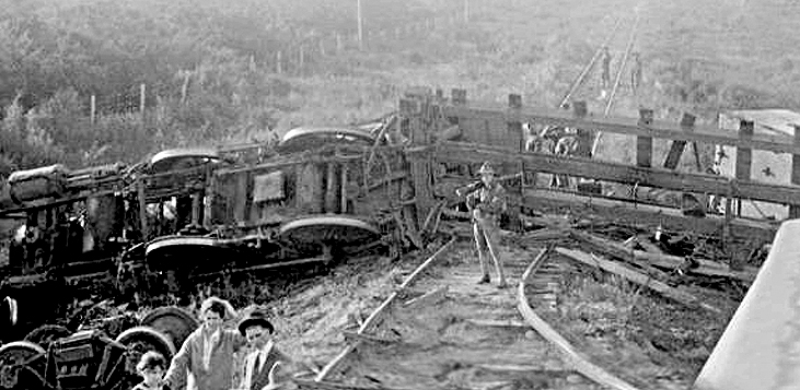
A group of sixty men swarmed the passenger cars shooting Anglos on
sight. In a span of only about fifteen minutes the train's engineer and
three passengers were killed and the fireman and three other passengers
were wounded. The raiders made off with about $325 in cash in addition
to jewels, watches and even shoes. They then headed across the Rio
Grande returning to Mexico.
History books declare that the holdup was the work of Tejanos and
Mexican renegades, using the chaos of the Mexican Revolution for their
own purposes; to get money, to kill whites or maybe even to wrest
control of the Southwest from America. But this was more than just an
extreme case of banditry. The wreck and robbery was part of a Mexican
invasion of Texas as laid out in the Plan de San Diego resulting in the
Bandit War.
The Plan de San Diego called for a popular uprising of American Blacks,
Hispanics and Indians in February 1915. They would capture Texas, New
Mexico, Arizona, Colorado and California which would all revert to
Mexican control. Most alarming to American residents living near the
border was the fact that the Plan ordered all Anglo males over the age
of 16 to be killed.

It is widely believed that the man behind this sinister plot was none
other than Venustiano Carranza, the brilliant, devious and ruthless de
facto ruler of Mexico at the time. It is unlikely that he really
believed that Mexico could regain control of Texas and the Southwest.
But the Plan could get him diplomatic recognition from the US
government. The key, of course, was to keep Carranza's role hidden from
the Americans and to blame his rivals or his Tejano allies for the
violence that was to come. He played on the arrogance of U.S. and Texas
officials, who believed that no Mexican was smart enough to pull off
such a deal.
In spite of the February start date, the offensive didn't really begin
until July 1915. A band of 30 Mexican raiders roamed across south Texas,
robbing and threatening residents, and killing at least one Anglo.
Under pressure from residents and commercial interests in the region
Texas Gov. James Ferguson created Texas Ranger Company D and appointed
Henry Lee Ransom as its first captain. Ransom was ordered to clean
things up using all means necessary. With a "shoot first and ask
questions later" reputation he was more than happy to comply.
On August 3, 1915 U.S. forces and a group of raiders battled at Aniceto
Pizaña's ranch, about 18 miles north of Brownsville. Pizaña, along with
former Cameron County Deputy Sheriff Luis de la Rosa, would become known
as combat leaders of the Plan de San Diego.
In the town of Sebastian, on August 6, a store was robbed by bandits who
captured and murdered two Anglos. Rangers and local law officers
responded by attacking the ranch of a suspected Plan member, killing him
and one of his sons.
Responding to reports that a Plan raid was in the works, a detachment
from the Army's 12th Cavalry, along with some customs inspectors and the
local deputy sheriff, went to Norias, home to the sub-headquarters of
the legendary King Ranch. On the evening of August 8 about 60 riders
attacked.
The American defenders held out for more than two hours, even though
four of them were wounded. The bandit leader was shot and killed during
the fighting and his followers decided to retreat, leaving seven Mexican
corpses behind.
Tensions were running high. The Anglos were in fear of a local uprising,
while Tejanos feared brutality from the Rangers. Governor Ferguson
responded to the crisis on the border by increasing the size of the
Ranger force and ordering almost all of it to south Texas.
General Frederick Funston, the commander of the Army's Southern
Department, believed that more raids were imminent. He positioned 40
small Army detachments, a total of 2,500 men, throughout South Texas.
Brutality was present on both sides of the conflict. Some Tejanos and
Mexicans who were thought to be tied to the Plan were simply killed, no
trial necessary. The Mexicans attempted a number of assassinations of
U.S. officials; a couple of which were successful. On September 24,
nearly 100 Plan fighters, accompanied by Carranza soldiers, crossed the
Rio Grande and attacked the town of Progreso. They looted and burned the
place, and captured Army Pvt. Richard Johnson, taking him with them
when they retreated back to Mexico. Johnson was executed, and two
Carranza men removed his ears as souvenirs. His head was cut off and
placed on a pole for the Americans to see.
On October 19, 1915 the United States gave diplomatic recognition to
Carranza as president of Mexico. Five days later, he ended the Bandit
War. True to his ruthless nature, Carranza abandoned his Tejano allies
leaving them to be captured or killed.
It is not clear just how many people died during the four months of the Bandit War. Some estimates go as high as 5,000.
What is clear is that this was truly a time of crisis along the border and the challenges we face here today pale in comparison.
August 2016 ...
Pancho Villa's Forces Fire Upon American Pilots Near Brownsville
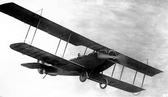
In September 1914 the 1st Aero Squadron
was organized based at North Island,
San Diego, California. In response to
tensions along the Texas - Mexico border
four pilots and three planes, Curtiss
JN-2s, were transferred to Ft. Brown in
Brownsville, Texas in March 1915.
On April 20, 1915 Byron Q. Jones took
off from Fort Brown with aviation pioneer,
Lt. Thomas D. Milling. Their mission
was to scout the forces of Pancho
Villa who were staging in the Mexican
city of Matamoros.
About 15 minutes into the flight, the
U.S. aircraft drew the attention of Villa's
forces, who opened fire with at least
one machine gun, as well as small arms.
Jones was able to maintain his composure
under fire. He opened the throttle
and nosed up, climbing to 2,600 feet to
avoid the gunfire. He maneuvered away
from the river and was able to return
safely to Fort Brown.
This marked the first time ever that an
American pilot was fired upon during an
aerial combat mission.